City Guide
The City Guide provides all key points of a city on a single digital platform through a GIS (Geographic Information Systems) infrastructure. With real-coordinate map data, it enables fast and accurate access to accommodation, tourist attractions, transportation, and public services. It is a comprehensive smart city solution that makes it easier for citizens and visitors to explore the city.
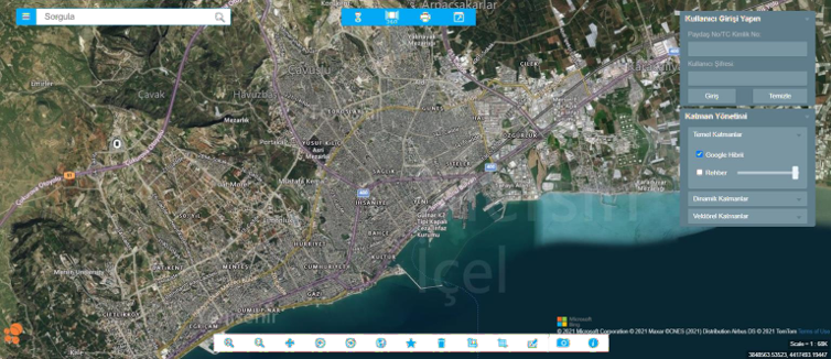
- Using GIS (Geographic Information Systems) infrastructure, the area you are in is displayed on the map with real-coordinate data
- Points of Interest
- Historical and Tourist Sites
- Accommodation Locations
- Nearby Places in the Surrounding Area
- On-duty pharmacies
- Route calculation
- Parcel and land registry information
- Advanced query options and much more
- Accessible with a single click for anyone planning to visit the city
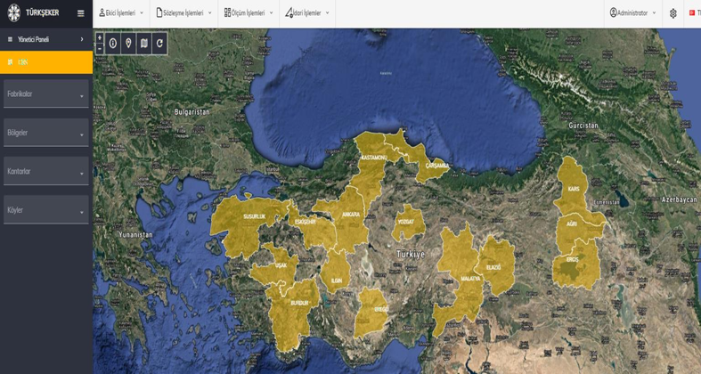
SUGAR BEET – AGRICULTURAL MONITORING AND MANAGEMENT PLATFORM
This platform enables the monitoring of sugar beet production processes on a regional, provincial, district, and village basis; it simplifies the entire process from planting to harvest, from contracts to quota tracking. Through a map-based interface, dynamic reports, and management panels, production areas, factories, weighing stations, and contracted farmers can all be monitored from a single center. With decision support mechanisms, agricultural planning and operational efficiency are enhanced.

GRAIN – PRODUCTION AND FIELD MONITORING PLATFORM
This grain platform enables the monitoring of production processes for products such as barley, wheat, corn, and sunflower in an integrated manner with Geographic Information Systems. Producers, cultivated areas, commitments, yields, and regional distributions can be analyzed through dynamic reports. Developed for both central and field teams, this system provides transparency, traceability, and sustainable management in grain production.